There's rarely a walk that doesn't involve a few minutes pondering the origin of some feature in the landscape. Take the Brampton circular walk as an example. Wander around the back of RAF Brampton and you come upon a field filled with bumps and hollows. Interesting enough in itself. But it's the pronounced hillock to the right that's always been a puzzle.
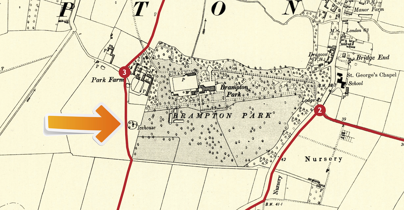
Wouldn't it be nice to have that kind of detail for every walk? Say no more! The 1900 Ordnance Survey maps with the routes tracked against them are being added to every walk.

No comments:
Post a Comment